Services
Transdisciplinary
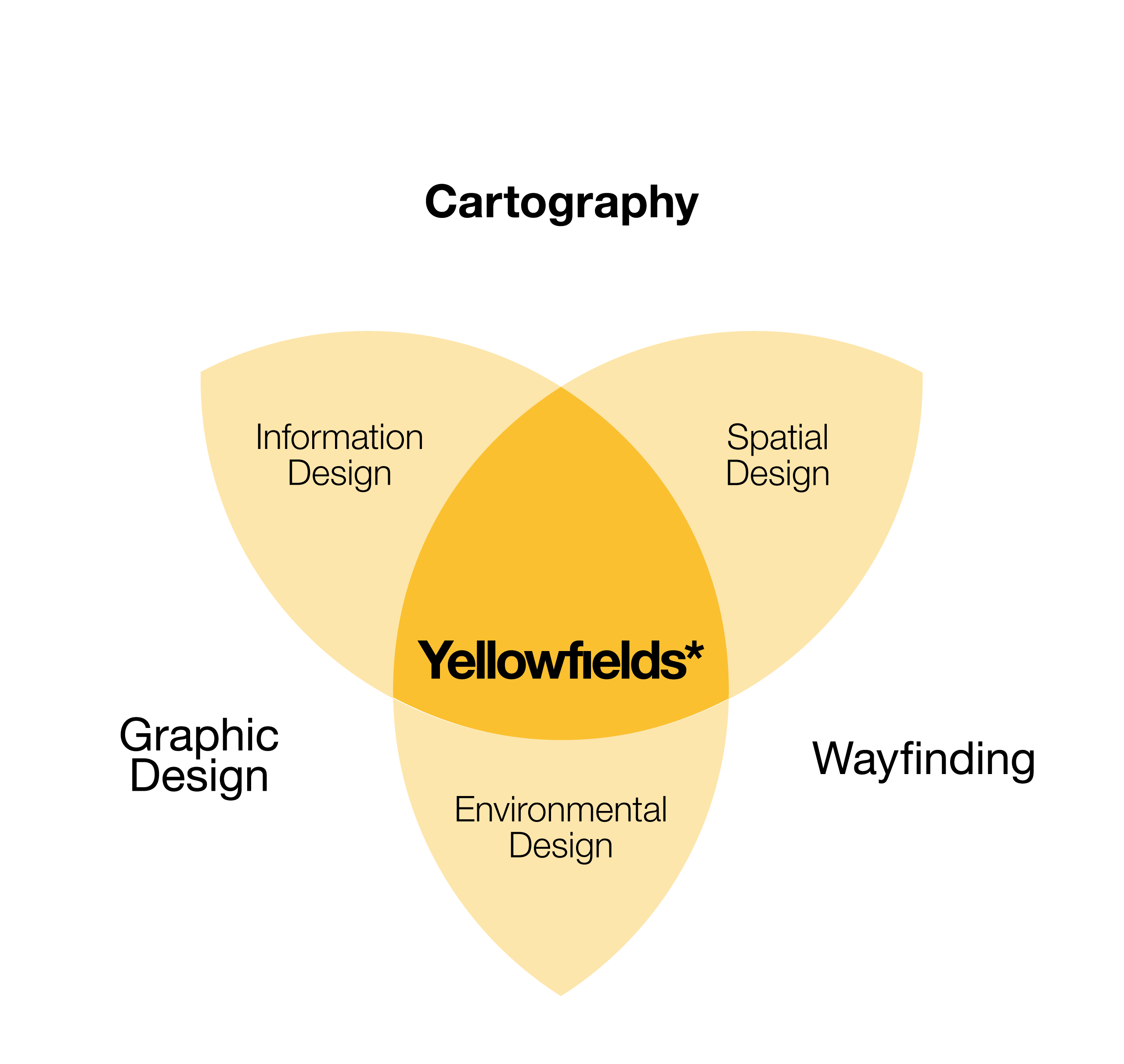
Jason’s core expertise and experience, spanning nearly four decades, is firmly rooted in cartography, but also encompasses graphic design and wayfinding — and occasionally, illustration. He describes this transdisciplinary practice as ‘spatial information design’. Moreover, transport and ‘design for movement’ have been prevailing themes in his work. The accompanying diagram summarises this well.
Cartography
As one of the oldest infographic (information design) forms, mapping is core to Jason’s practice. Communicating both physical and digital landscapes, maps are meticulously designed and crafted whether topographical, topological, thematic, abstract, or artistic in form.
Jason specialises in bespoke mapping solutions, with particular experience in visitor mapping and wayfinding. In this respect, his design approach ‘encourages exploration and discovery, which better informs and enhances the visitor experience and memory of place.’“In a world where more maps are being made than ever before, cartography doesn’t need reinvention; it needs understanding!”
Jason employs a wide array of tools and techniques to examine and manipulate spatial data before translating this in to the final map(s). These tools encompass geographic information systems (GIS), specialised spatial data analysis, processing frameworks and toolkits, and professional illustration software for the design and production.
Graphic Design
Effective visual communication is paramount to connecting with your audience and fully realising your ideas, proposals or message(s). Jason can assist with the design and production of technical reports, brochures, leaflets, posters, interpretations, signage, and online assets for both print and digital platforms.
“Perfection is achieved not when there is nothing more to add, but when there is nothing left to take away.”
Jason’s expertise lies in working with information-heavy themes, and designing information-rich environments. Clarity and simplicity are the guiding principles in the search for solutions—eliminating the obvious and incorporating the meaningful. He focuses on content, functionality, intuitiveness and accessibiliyty.
Wayfinding
Much of Jason’s latter experience (15+ years) has been in wayfinding—creating ‘communicative environments’ that are information-rich and accessible through mapping, signs and other devices. With reference to the disciplines of information design, spatial design and environmental design, Jason assists with the design of physical signage, supporting information systems and graphics within a developed wayfinding system. In collaboration with co-authors, he can create and produce wayfinding strategies and implementation guidance.
Outputs
Jason’s deliverables are grounded in the disciplines of cartography, graphic design and wayfinding, and span both print and digital media. As a snapshot of the types of deliverables Jason can provide, explore these selected works (available from the home page). Alternatively, you can also view this automated slideshow of maps and related graphics.
“Design is the intermediary between information and understanding.”
Apart from the design and production of print and digital products, Jason also provides advice and consulting services, such as design audits, design direction and development, desktop-based research, project feasibility and analysis, workflow assessment, and wayfinding strategy and implementation.
