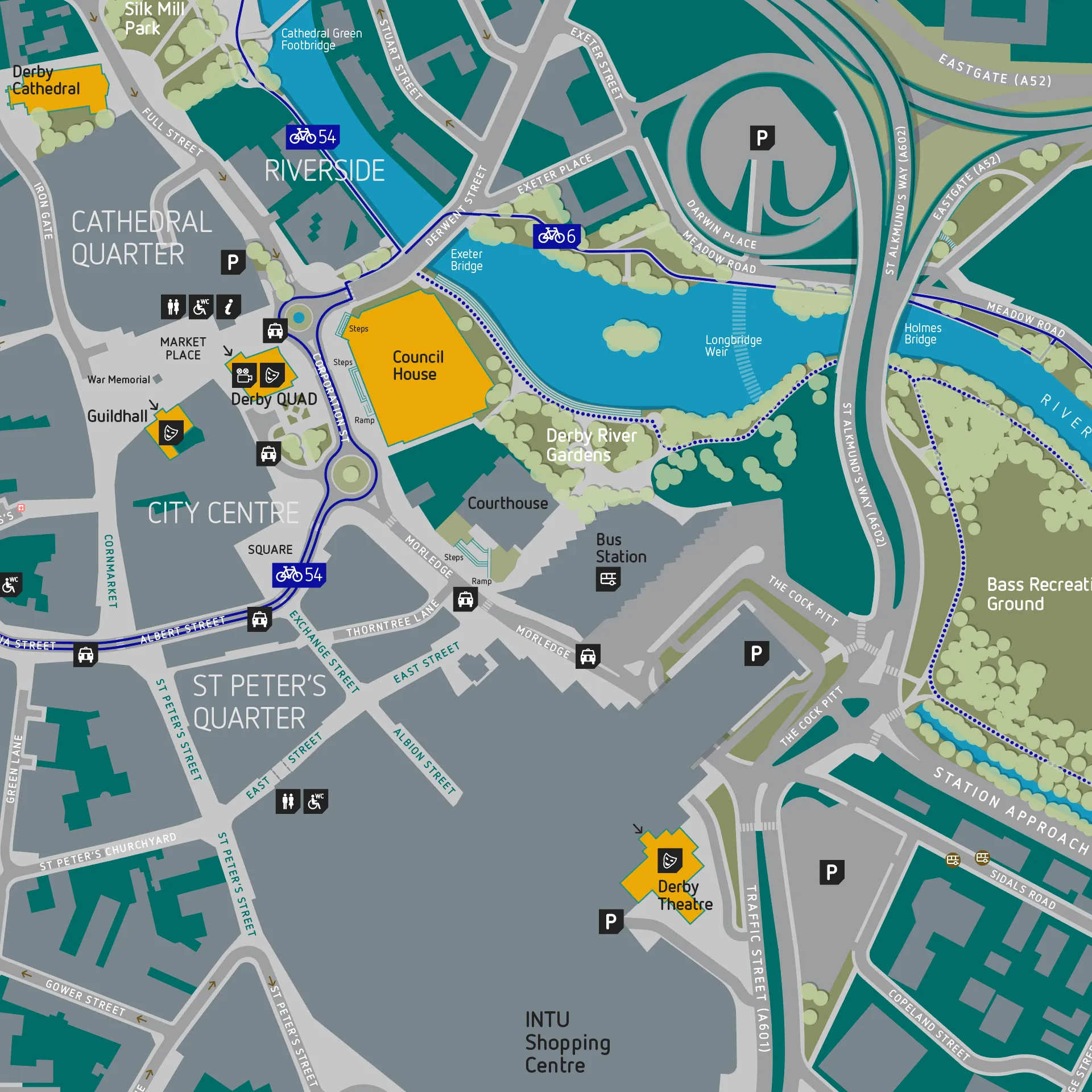
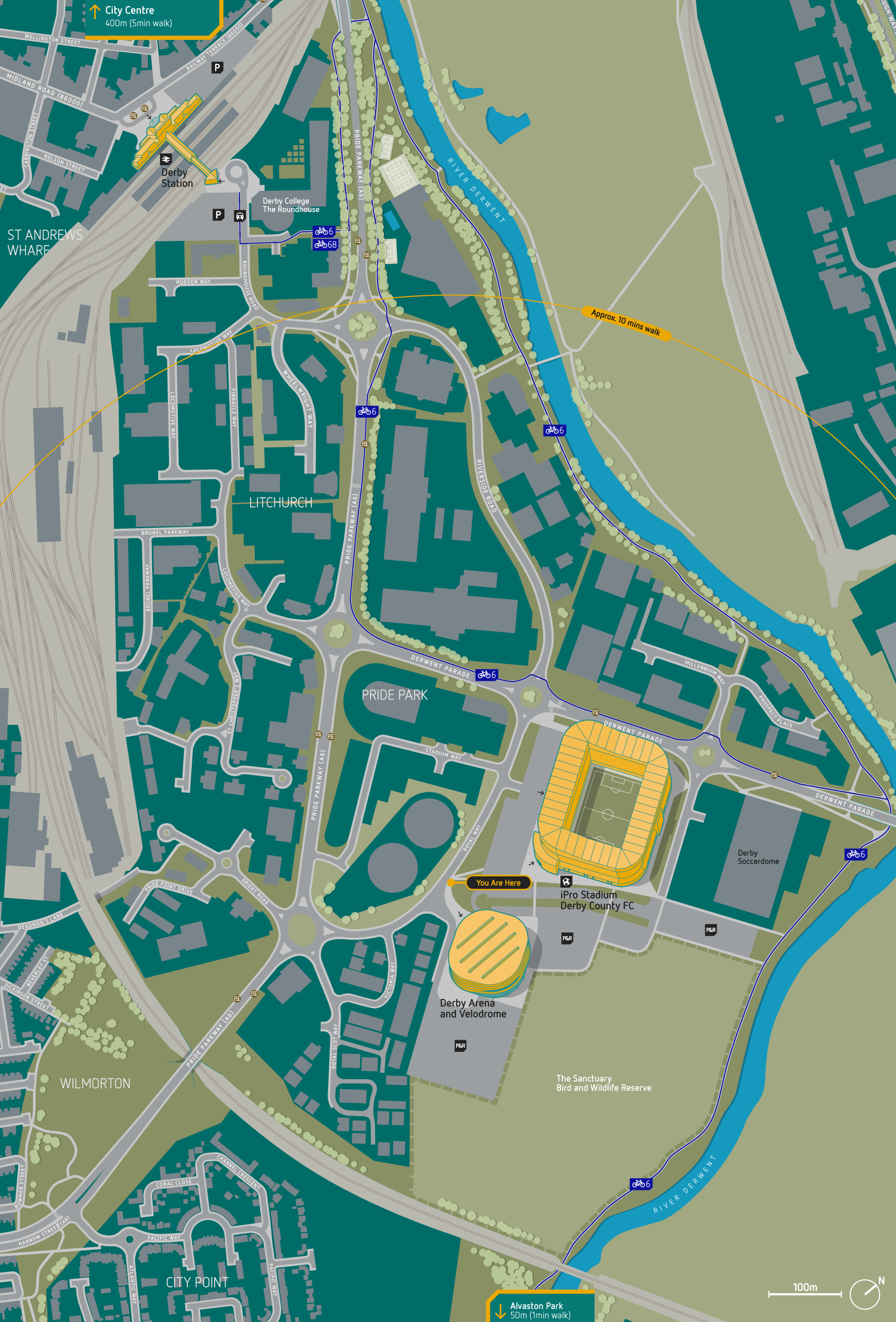
Derby Riverside Wayfinding Map

Jason was commissioned by Derby City Council to create new mapping for signing to promote the recreational area known as ‘Derby Riverside’. The mapping was aimed at walkers, cyclists and those using public transport. The mapping also included a number of 3D landmark buildings. The maps and signs had to identify themselves as part of a scheme separate from the broader city wayfinding system.

“Jason went beyond our expectations to ensure that the project was delivered to our requirements. The project was completed on time and to budget. We highly recommend Jason’s design services.”